Press & Media
Facts last reviewed 2026-08-08
This page collects verifiable information about GoSurvive for writers, storefronts and reference works. Everything below can be checked against the game itself or its store listings. Text and images on this page may be reproduced without asking.
Fact sheet
- Title
- GoSurvive
- Google Play listing
- GoSurvive: GPS City Tycoon
- App Store listing
- GoSurvive: Buy Your City
- Developer
- GoSurvive
- Genre
- Location-based game, real-estate simulation, exergame
- Platforms
- Android, iOS, web browser
- Android release
- 7 June 2026
- iOS release
- 12 June 2026
- Price
- Free to download and play
- Modes
- Single-player with persistent shared world, asynchronous PvP
- Languages
- English, Ukrainian, Spanish, Portuguese, German, Chinese
- Website
- gosurvive.app
Descriptions
Three lengths, written to be quoted directly.
GoSurvive is a location-based mobile game in which players walk in the real world to scout, buy and manage real buildings drawn from OpenStreetMap data.
GoSurvive is a location-based mobile game for Android and iOS in which the playing field is the real world. Buildings are imported from OpenStreetMap and Microsoft Building Footprints, and each one is valued from its actual attributes — footprint area, number of storeys, building type and local density. Players walk to scout buildings near them, buy full or fractional stakes, collect accumulated rent by physically returning to the property, and keep it from falling into disrepair. Owned buildings project territory that merges into contiguous districts, and districts are scored on how well their residential, commercial, civic, industrial and leisure functions supply one another.
GoSurvive is a location-based mobile game for Android and iOS, also playable in a web browser, in which players build a property portfolio out of real buildings. Building geometry comes from OpenStreetMap and Microsoft Building Footprints; a building’s value is derived from its footprint area, storey count, type and surrounding density rather than from its real market price, and that value sets the rent it pays.
The core loop is physical. Walking near a building scouts it automatically and pays a cash bounty; walking back into range of a building the player owns collects the rent that has accumulated there and repairs its condition, which otherwise decays daily. Rent can be collected remotely only at a fee and on a cooldown, so distance has a running cost.
Above that sit the management layers. Owned buildings project a radius of territory that merges with neighbouring holdings into districts; overlapping claims from different players are resolved by proximity, and buildings inside a rival’s influence earn less. Each district is scored on the balance of its residential, commercial, civic, industrial and leisure buildings, which form a closed supply chain — each function consumes the good the previous one produces. A district whose chain is starved pays a fraction of its potential income, so players ship goods between districts to fill the gaps. Tenants, roof upgrades, per-building perks, franchise routes between distant properties and asynchronous step-based player-versus-player matches layer on top.
The game also includes an OpenStreetMap editor: players can correct the name or type of a building they are standing next to, and the change is submitted upstream under their own OpenStreetMap account.
How the game works
A new player claims one nearby building for free, then walks. Buildings near the player's route are scouted automatically and pay a cash bounty; that cash buys full or fractional ownership of other buildings, which then pay rent. Rent accumulates in the building and is collected by walking back into range, which also restores the building's condition — condition decays continuously, and a building left at zero is repossessed.
Ownership creates territory. Each owned building projects a radius that merges with adjacent holdings into a district, and where two players' territories overlap the ground is awarded by proximity. Districts are scored on the balance of their residential, commercial, civic, industrial and leisure buildings, which consume one another's output in a closed loop; a district whose supply chain is starved earns a fraction of its potential income, which players resolve by delivering goods on foot.
The full rule set, including the valuation and income formulas, is published at gosurvive.app/manual.
Map data and attribution
Building footprints and attributes come from OpenStreetMap, licensed under the Open Database License, supplemented by Microsoft Building Footprints. A building's in-game value is derived from its recorded footprint area, storey count, type and local density. It is not an estimate of real market value, and ownership in the game confers nothing in the real world.
GoSurvive also includes an OpenStreetMap editor. Players may correct the name or type of a building they are physically next to; edits are additive only, are submitted under the player's own OpenStreetMap account, and follow the Organised Editing Best Practices. Our statement under those guidelines is published at gosurvive.app/osm-editing.
Technology
- Client
- SvelteKit, packaged for mobile with Capacitor
- Map rendering
- MapLibre GL with a Three.js layer for 3D buildings
- Server
- Node.js
- Database
- PostgreSQL with PostGIS and H3 spatial indexing
- Building geometry
- OpenStreetMap and Microsoft Building Footprints
Screenshots and logos
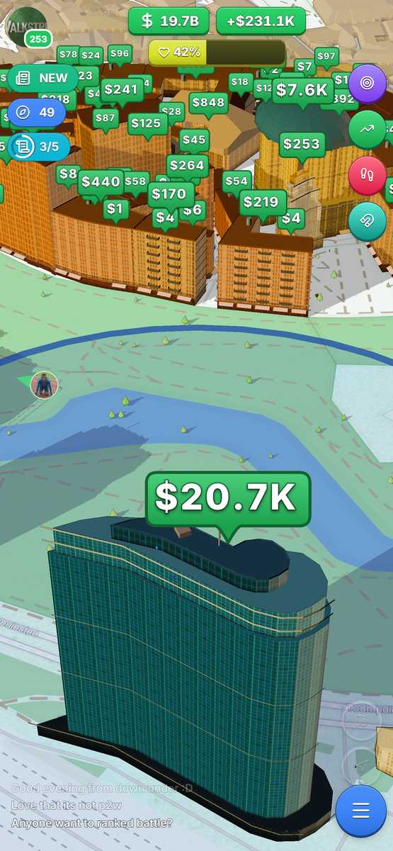
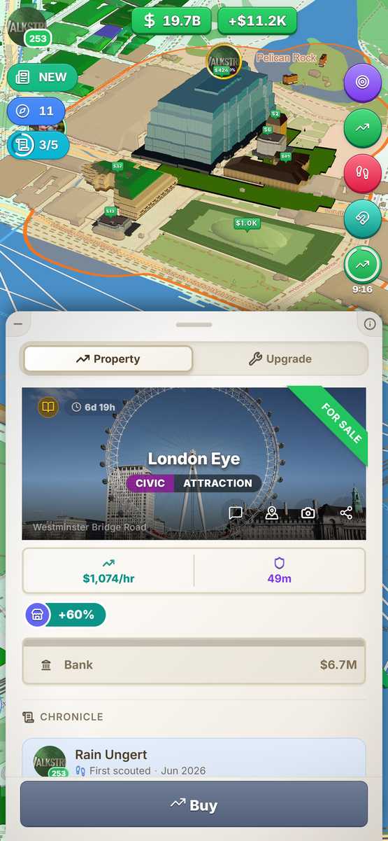
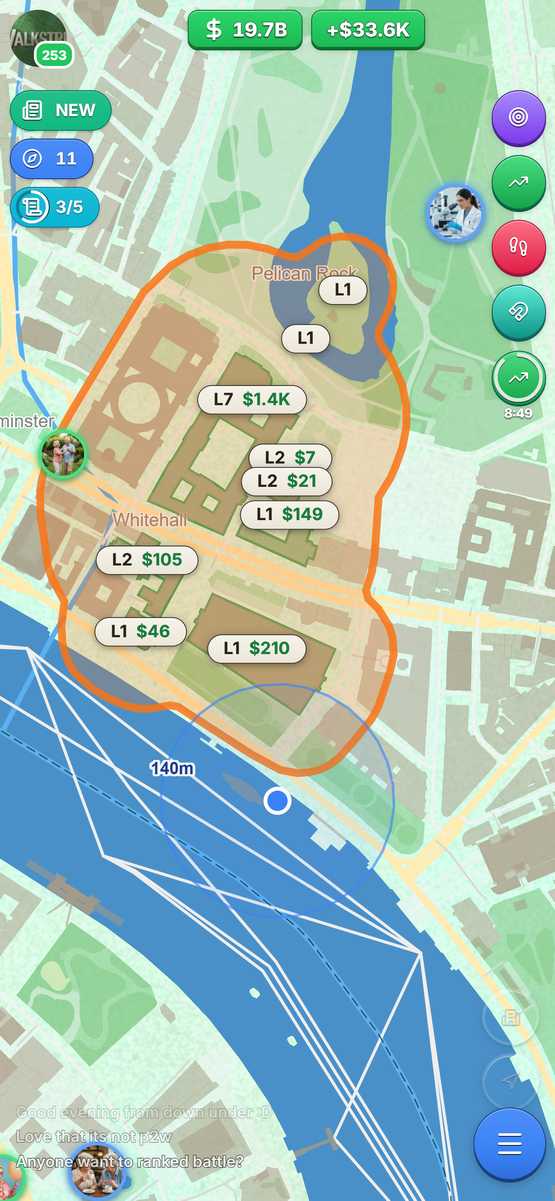
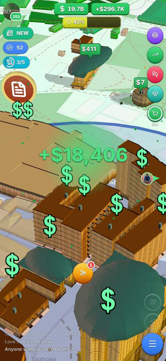
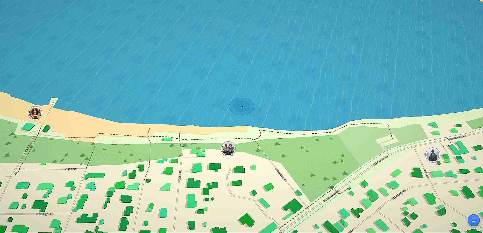




The name is written GoSurvive — one word, capital W and capital S.
Contact
- Email: [email protected]
- Community: discord.gg/NRjUmpthHn